La Bresse Brabant
880 mVillage altitude
980 mTop of the ski area
3 kmAlpine pistes
3Ski lifts
Not published by any source: adult day pass.
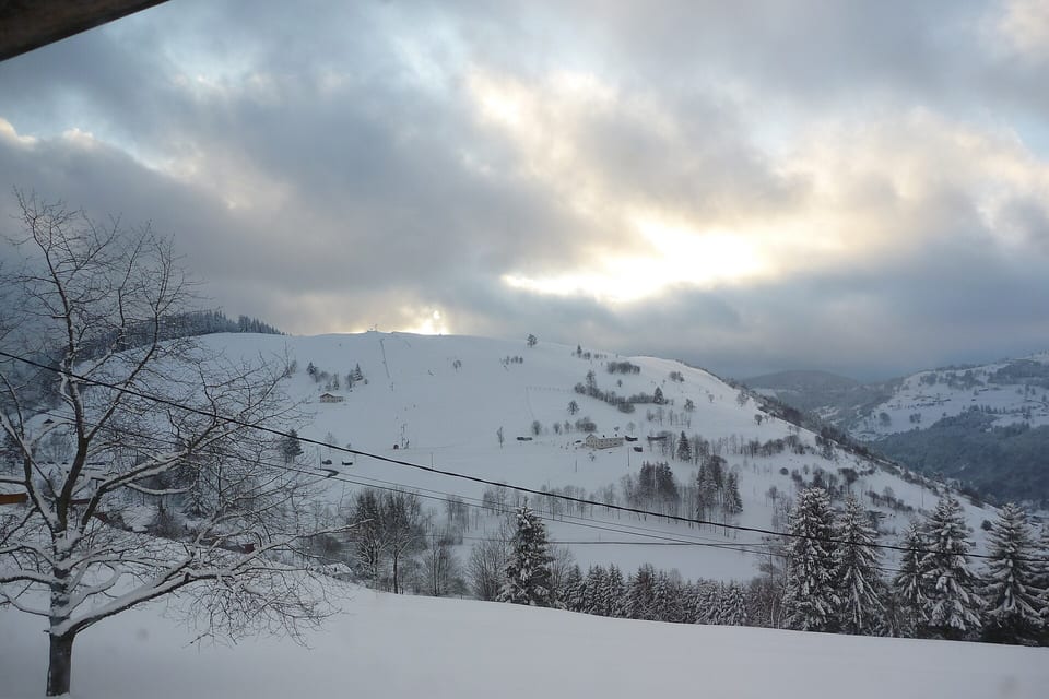
La Bresse Brabant is a small French ski resort located in the Vosges in the commune of La Bresse at the col du Brabant. It features three ski lifts and eight downhill slopes.
Live webcams
All webcams (5) →Haut de VologneSkaping
HohneckSkaping
LispachSkaping
Each player is the camera operator’s own, loaded only when you ask for it — it may set its own trackers.
Official players of the resort, live image. 1 more camera on the webcam page. Checked on 12 September 2026.
Snow, opening and weather
Snow report →Open pistes and lifts will appear here during the season, as published by the resort. Out of season we show nothing rather than a misleading zero.
Natural snow is low on average: skiing depends on snowmaking and good years. 8 days a winter at 30 cm or more on average, measured over 10 winters at the Météo-France “LA_BRESSE_SAPC” station. Fortnight by fortnight, over 10 measured winters →
3-day forecast
Village 880 m · top 980 m
Forecast corrected for altitude; fresh snow = forecast total at the top; UV = peak of the day. Beyond 3 days, check the resort’s own report. Source:Open-Meteo.
Seven criteria rated from 1 to 5 stars, in half-stars, from this page's sourced data. A rating is a rank among the 315 French resorts we cover — 5 stars means “among the best in France on this point”, not “perfect”. Nobody types these in.
- SnowCan you count on the snow?1 / 5
Top of the ski area: 980 m · Bottom of the pistes: 866 m · Days above 30 cm per winter, measured: 8 days · Days above 30 cm, December to March, model: 2%
- Ski areaIs there enough to ski all week?2 / 5
Km of pistes at the resort: 3 km · Lifts: 3 · Balance between piste levels: 95%
- ValueIs the lift pass reasonable for what you get?n/a
Not rated: no official price list could be found.
- Families and beginnersIs it right for children and beginners?1.5 / 5
Share of green and blue pistes: 38% · Magic carpets: 0 · Sledging runs: 0 · Ice rink, pool, rail sledge…: 2
- AccessIs it easy to get to?2 / 5
Average drive time from 20 major cities: 6 hr 09 · Nearest railway station: 33 min · Station-to-resort shuttles per day: 0 · Nearest airport: 1 hr 33
- Atmosphere and après-skiIs there life in the evening and off the slopes?3 / 5
Bars and pubs: 3 · Nightclubs: 0 · Restaurants: 12 · Upcoming events: 1 · Collective tourist beds: 0 — index: what the map and the listings publish
- Luxury and comfortHow upmarket is the resort?2.5 / 5
5-star hotels: 0 · 4-star hotels: 1 · Spas and saunas: 0 · Jewellers, watchmakers, fashion boutiques: 1 — index: what the map and the listings publish
“Atmosphere” and “Luxury” are indexes: they count what OpenStreetMap and the event listings publish within 2.5 km (bars, nightclubs, rated hotels, spas, upcoming events), not what you experience there. A zero means “nothing mapped”, not “nothing there”. Sources per criterion: snow (altitudes declared by the resort (ANMSM, official website), STRMTG register, OpenStreetMap; snow depth observed at the Météo-France station, ERA5-Land model) ; ski area (figures declared by the resort (ANMSM, official website), national lift register (STRMTG), OpenStreetMap) ; value (the resort’s official price list) ; families and beginners (OpenStreetMap pistes, price list, ESF ski school, Famille Plus label, OpenStreetMap leisure) ; access (OSRM drive times from 20 cities, SNCF stations, GTFS shuttles, airports) ; atmosphere and après-ski (bars, nightclubs and restaurants within 2.5 km (OpenStreetMap), upcoming events (OpenAgenda), collective tourist beds (INSEE)) ; luxury and comfort (rated hotels within 2.5 km (OpenStreetMap) and by category across the commune (INSEE), spas and boutiques (OpenStreetMap), day pass price).
8 pistes, by level
1 green2 blue2 red3 black
- Skiable vertical
- 114 m
- Cross-country skiing
- 2 km of nordic trails
Ski-area figures — bottom, km of pistes, pistes by level: OpenStreetMap (1 Oct); top, lifts: STRMTG — French national lift register (1 Jan) .
The ski area in figures
Measured on 7 October 20260 kmLongest piste — Les Balcons de La Bresse (black), 102 m of vertical
103 mBiggest vertical without changing piste — 969 → 866 m, 0 km
980 mHighest lift top — Brabant G 40 (platter lift), national lift register
1,920Total lift capacity, people per hour — 3 installations: 3 drag lifts
50 yrsAverage age of the lift fleet — oldest 1971, newest 1983
720Biggest lift, people per hour — Tête de minuit (platter lift, 1971)
1 kmTotal length of lifts — 4 lifts mapped
15 haSki area boundary (OSM)
3,027Inhabitants — Cornimont (INSEE 88116)
Measured on OpenStreetMap (altitudes: IGN RGE ALTI), not taken from the brochure. The vertical above is that of one piste, not of the whole ski area. Population: INSEE municipal population via geo.api.gouv.fr.
Source: national register of mechanical lifts (STRMTG, CAIRN), fleet as of 1 January 2025 — lifts attributed to La Bresse Brabant only (“BRESSE (LA) COL DU BRABANT”), magic carpets included.
Staying and hiring gear in La Bresse Brabant
The partners covering this resort, shown side by side, and the shop to kit out before you leave. Some links earn us a commission — never at the expense of the price or of the data.
Collective accommodation
- 1 campsite · 60 pitches
Commune: Cornimont · INSEE tourist accommodation survey, 2026, read on 12 September 2026. Collective accommodation only — privately let flats and second homes are not counted. INSEE dataset ↗
Stay & accommodation
Holidu
Holiday-rental comparison site.
Gear & equipment
Absolute Snow
UK ski and snowboard shop — delivers to UK addresses only.
Hardloop
Mountain gear shop: ski touring, avalanche safety, winter clothing.
Beyond skiing at La Bresse Brabant
Ice rink
- Patinoire · La Bresse · 1.6 km away
- Centre Aquatique et de Bien-Être - Patinoire · Gérardmer · 8.8 km away
Swimming pool
- Complexe piscine loisirs · La Bresse · 1.7 km away
- Bien-être à l'hôtel les vallées · La Bresse · 2.5 km away
- Centre Aquatique et de Bien-Être - Piscine · Gérardmer · 8.8 km away
Dog sledding
- Tribu Vagabonde - chiens de traineau · Cornimont · 0 km away
- Canirando avec Chiens de Traîneau Vosges · Cornimont · 1.8 km away
Paragliding
- Couleur vent manu tremsal vols biplace parapente · La Bresse · 2.5 km away
- Benoît perrin parapente · La Bresse · 2.5 km away
- Bol d'air - parapente · La Bresse · 3.5 km away
- Cumulus parapente · Gérardmer · 6.9 km away
Cinema
- Cinéma grand écran · La Bresse · 2 km away
- Cinéma du Casino Joa · Gérardmer · 9.2 km away
- Cinéma de la Maison de la Culture et des Loisirs · Gérardmer · 9.5 km away
Bowling
- Bowling La Bresse · 1.7 km away · OpenStreetMap
Source: DATAtourisme (open data), within 10 km of the resort; places in a large town of the valley are left out. Checked on 12 September 2026. Lines marked OpenStreetMap come from the map, within 3 km — opening times on site. Opening times and prices are the operator’s — check before you go.
Ski schools and practical information
Tourist office
Office du Tourisme de La Bresse
In case of accident
112 — the European emergency number, free of charge, triggers mountain rescue. On the pistes, the ski patrol number is printed on the piste map and at lift ticket offices. Piste rescue is charged: check your insurance or take the option sold with the lift pass.
Off the pistes: off-piste and ski touring
The resorts for off-piste skiing →Ski touring routes described
12 ski touring routes documented within 10 km of La Bresse Brabant — up to 1,295 m of climb.
| Summit and route | Ski grade | Climb | Altitude | Aspect | From resort |
|---|---|---|---|---|---|
| Tête des Corbeaux · Par les Bouchaux + aller retour sur les Ecorces | 1.3 · E1 · F | 880 m | 623 → 1,086 m | NW | 1.7 km |
| La Bresse · roche beuty | n/a · AD | 250 m | 710 → 960 m | N | 3.4 km |
| Haut Rouan · depuis la Vallée du Chajoux | n/a · PD- | 750 m | 710 m | SW · W | 3.7 km |
| Ermitage Frère Joseph à Ventron · Tricotage à Frère Jo | n/a | n/a | n/a | n/a | 6.9 km |
The other 8 routes, with grades and vertical →
Not a piste. Neither marked, nor patrolled, nor secured: transceiver, shovel, probe, the day’s avalanche bulletin and, better still, a guide. Ski grade (1.1–5.6) = steepness and commitment; exposure (E1–E4) = consequence of a fall.
Source: Camptocamp.org topo guide (CC BY-SA), routes starting within 10 km, read on 13 October 2026. Descriptions and photos are on Camptocamp; an empty cell is a field nobody has filled in. Camptocamp ski touring routes ↗
Piste map
Open on OpenSnowMap ↗Official piste map
Pistes coloured by level, lifts as lines. The resort’s official map is the reference in season.
Base map © OpenTopoMap (CC-BY-SA) · pistes © OpenSnowMap (CC-BY-SA) · data ©OpenStreetMap contributors (ODbL).
Getting to La Bresse Brabant
From Paris: 5 hr 19 (447 km) by road.
By road
- From Nancy: 1 hr 49 · 124 km
- From Strasbourg: 2 hr 01 · 128 km
- From Besançon: 2 hr 21 · 136 km
- From Dijon: 3 hr 08 · 218 km
- From Genève: 4 hr 30 · 277 km
From other major cities (15)
- From Lyon: 4 hr 44 · 376 km
- From Annecy: 5 hr 00 · 321 km
- From Paris: 5 hr 19 · 447 km
- From Chambéry: 5 hr 28 · 363 km
- From Grenoble: 5 hr 31 · 463 km
- From Saint-Étienne: 5 hr 33 · 436 km
- From Valence: 5 hr 50 · 476 km
- From Clermont-Ferrand: 6 hr 10 · 516 km
- From Montpellier: 7 hr 53 · 677 km
- From Marseille: 7 hr 58 · 686 km
- From Nice: 9 hr 11 · 746 km
- From Perpignan: 9 hr 15 · 825 km
- From Bordeaux: 9 hr 42 · 856 km
- From Toulouse: 9 hr 47 · 860 km
- From Pau: 11 hr 43 · 1051 km
Excluding traffic and winter conditions; passes closed in winter are avoided.
By train
Kruth station
halt · then 33 min drive (25 km)
Nearest main station: Colmar, 1 hr 07 by road.
No direct bus line from the station to the resort appears in the open-data timetables (checked on 11 October 2026): ask the resort about a private shuttle or a taxi.
Shuttles and buses from the station: see the resort’s official website.
By plane
- Bâle-Mulhouse (BSL): 1 hr 33 by road · 91 km
- Strasbourg-Entzheim (SXB): 1 hr 55 by road · 118 km
Take me there
These links open the app with La Bresse Brabant as the destination. Your starting point is never sent by us — the app asks you for it, if you agree.
Charging an electric car
No freely accessible charge point is declared within 2 km of the resort (checked on 9 October 2026). Covered car parks in the resort may offer chargers reserved for their customers: those are not listed here.
Freely accessible charge points read from the French national EV charging database (data.gouv.fr ↗, operators’ own declarations), checked on 9 October 2026. Check availability before you leave: the database says what is installed, not what is free tonight.
Road conditions
From 1 November to 31 March, snow chains or winter tyres are compulsory in most mountain areas (French “Loi Montagne II”).
Driving times computed on the OpenStreetMap road network (OSRM), SNCF stations (open data), airports (Wikidata). Indicative, not a timetable: allow extra time in snow.
Translated from the French Wikipedia article (CC BY-SA), machine translation.
Frequently asked questions
How high is La Bresse Brabant?
La Bresse Brabant sits at 880 m at village level, and its ski area rises to 980 m.
How many kilometres of pistes does La Bresse Brabant have?
La Bresse Brabant has 3 km of slopes, 3 lifts.
What is the longest piste in La Bresse Brabant?
The longest piste is Les Balcons de La Bresse: 0 km (black run), for 102 m of vertical. Measured on the OpenStreetMap map, segments of the same name and level joined end to end, altitudes from the IGN RGE ALTI terrain model — a resort sometimes advertises a longer run by chaining several pistes.
How high do the lifts go in La Bresse Brabant?
The highest lift, Brabant G 40 (platter lift), tops out at 980 m. Source: STRMTG, French national register of mechanical lifts (CAIRN database), file dated 1 January 2025.
How many lifts does La Bresse Brabant have, and what is their capacity?
The French national register of mechanical lifts records 3 installations at La Bresse Brabant (3 drag lifts), for an authorised capacity of 1,920 people per hour, of which 720 for Tête de minuit alone. The fleet spans 1971 to 1983, an average age of 50 years. This count covers the resort itself, magic carpets included, not the whole linked ski area — a resort brochure often announces a different number. Source: STRMTG, French national register of mechanical lifts (CAIRN database), file dated 1 January 2025.
How do I get to La Bresse Brabant?
By road, La Bresse Brabant is 1 hr 49 from Nancy (124 km), excluding traffic and winter conditions. By train, the nearest station is Kruth, 33 min by road from the resort. No direct bus line from the station to the resort appears in the open-data timetables. The nearest airport is Bâle-Mulhouse, 1 hr 33 away.
How long is the drive from Paris to La Bresse Brabant?
5 hr 19 for 447 km from central Paris, excluding traffic and winter conditions. Computed on the real road network (OpenStreetMap): allow more on a school-holiday Saturday.
Is the snow reliable in La Bresse Brabant?
Natural snow is low on average: skiing depends on snowmaking and good years. 8 days a winter at 30 cm or more on average, measured over 10 winters at the Météo-France “LA_BRESSE_SAPC” station. This verdict rests on 10 winters of Météo-France measurements (2016-2026); in season the daily report prevails.
Is La Bresse Brabant good for beginners and families?
38% of the pistes are green or blue: a rather technical area.
Nearby resorts
Full page in French. The French page carries the editorial guides and a few extra readings; every figure, webcam and price on this page is the same one. La Bresse Brabant in French →
Every figure carries its source and date; a missing figure shows as “—”, never estimated. Embed this widget on your site