Le Corbier
Le Corbier is a ski resort in the Northern Alps (Savoie). The village sits at 1,569 m and the ski area rises to 2,225 m, a skiable vertical of 425 m.
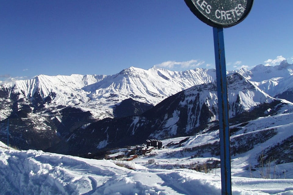
The area offers 99 km of alpine pistes, 126 marked pistes (40 green, 47 blue, 32 red, 7 black), 49 ski lifts, plus a snowpark. Green and blue runs dominate: terrain suited to beginners and families.
Le Corbier belongs to the linked Les Sybelles area: one lift pass covers the neighbouring resorts.
Measured on the OpenStreetMap map: the longest piste runs 8 km (Col des Lacs) and the highest lift tops out at 2,587 m.
The resort holds the Famille Plus and Station classée de tourisme labels.
Access: 1 h 12 by road from Chambéry and 20 min from Saint-Jean-de-Maurienne Arvan railway station.
6 official webcams show the pistes live (on the French page).
Seven criteria rated from 1 to 5 stars, in half-stars, from this page's sourced data. A rating is a rank among the 322 French resorts we cover — 5 stars means “among the best in France on this point”, not “perfect”. Nobody types these in.
- SnowCan you count on the snow?3.5 / 5
Top of the ski area: 2,225 m · Bottom of the pistes: 1,800 m · Days above 30 cm per winter, measured: 88 days · Days above 30 cm, December to March, model: 74%
- Ski areaIs there enough to ski all week?4 / 5
Km of pistes at the resort: 99 km · Km of pistes across the linked area: 125 km · Lifts: 49 · Balance between piste levels: 90%
- ValueIs the lift pass reasonable for what you get?2.5 / 5
Adult day pass: €60.5 · Day pass price per km of pistes: €0.61/km · Adult 6-day pass: €307.2
- Families and beginnersIs it right for children and beginners?3.5 / 5
Share of green and blue pistes: 69% · Magic carpets: 10 · Sledging runs: 0 · Special prices out of 4 (beginner, child, family, free age): 3 · ESF ski school · Ice rink, pool, rail sledge…: 6 · Famille Plus label
- AccessIs it easy to get to?3 / 5
Average drive time from 20 major cities: 4 hr 35 · Nearest railway station: 20 min · Station-to-resort shuttles per day: 0 · Nearest airport: 1 hr 23
- Atmosphere and après-skiIs there life in the evening and off the slopes?3 / 5
Bars and pubs: 0 · Nightclubs: 2 · Restaurants: 22 · Upcoming events: 0 · Collective tourist beds: 2,139 — index: what the map and the listings publish
- Luxury and comfortHow upmarket is the resort?1.5 / 5
5-star hotels: 0 · 4-star hotels: 0 · Share of hotel rooms in 4 and 5 stars: 0% · Spas and saunas: 0 · Jewellers, watchmakers, fashion boutiques: 0 · Adult day pass: €60.5 — index: what the map and the listings publish
“Atmosphere” and “Luxury” are indexes: they count what OpenStreetMap and the event listings publish within 2.5 km (bars, nightclubs, rated hotels, spas, upcoming events), not what you experience there. A zero means “nothing mapped”, not “nothing there”. Sources per criterion: snow (altitudes (OpenStreetMap, Wikidata), snow depth observed at the Météo-France station, ERA5-Land model) ; ski area (OpenStreetMap pistes and lifts, linked area (Wikidata)) ; value (the resort’s official price list) ; families and beginners (OpenStreetMap pistes, price list, ESF ski school, Famille Plus label, OpenStreetMap leisure) ; access (OSRM drive times from 20 cities, SNCF stations, GTFS shuttles, airports) ; atmosphere and après-ski (bars, nightclubs and restaurants within 2.5 km (OpenStreetMap), upcoming events (OpenAgenda), collective tourist beds (INSEE)) ; luxury and comfort (rated hotels within 2.5 km (OpenStreetMap) and by category across the commune (INSEE), spas and boutiques (OpenStreetMap), day pass price).
The domain is due to open on 12 December 2026 and close on 9 April 2027. Open pistes and lifts will appear here as soon as the resort publishes its daily report.
Right now at the ST-SORLIN D'ARVES station (1,694 m)
Avalanche danger
7-day forecast
Village 1,569 m · top 2,225 m
Forecast corrected for altitude; fresh snow = forecast total at the top; UV = peak of the day. Beyond 3 days, check the resort’s own report. Source:Open-Meteo.
Average snow depth by month
Reliable snow mainly in February; more irregular the rest of the winter.
☀️ Average daily sunshine : Nov 6.5 h · Dec 5.7 h · Jan 6.1 h · Feb 7.4 h · Mar 8.4 h · Apr 9.9 h — 26 bright days in April (Open-Meteo estimate, 2015-2025).
- November—no record
- December40 cmVariable · 61%
- January50 cmVariable · 77%
- February64 cmGood skiing · 87%
- March61 cmVariable · 70%
- April33 cmInsufficient · 36%
- May—no record
30 cm on the ground: the benchmark for groomed-piste skiing. Bar = monthly average depth; percentage = share of time above 30 cm.
- Good skiing: 30 cm on more than 8 days in 10
- Variable: 30 cm on 5 to 8 days in 10
- Insufficient: 30 cm less than one day in two
Snow actually measured, winter by winter
32 complete winters measured, from 1992-1993 to 2025-2026 — on average 88 days a winter with at least 30 cm on the ground.
- 1-15 Dec25 cmInsufficient · 34 %
- 16-31 Dec35 cmVariable · 53 %
- 1-15 Jan49 cmVariable · 70 %
- 16-31 Jan62 cmGood skiing · 85 %
- 1-15 Feb73 cmGood skiing · 89 %
- 16-29 Feb76 cmGood skiing · 88 %
- 1-15 Mar71 cmVariable · 77 %
- 16-31 Mar46 cmVariable · 57 %
- 1-15 Apr24 cmInsufficient · 32 %
- Best winter of the series
- 2012-2013 — 136 days at 30 cm or more
- Worst winter of the series
- 1992-1993 — 3 days at 30 cm or more
How much snow actually falls — 371 cm a winter on average, spread over 35 days of snowfall. Measured over 27 complete winters, from 1992-1993 to 2019-2020.
- Biggest 24-hour snowfall
- 70 cm — 2011-2012
- Snowiest winter
- 2017-2018 — 621 cm
- Leanest winter
- 1992-1993 — 138 cm
The ski area
Compare with another resort →126 pistes, by level — 99 km
- Skiable vertical
- 425 m (1,800 m → 2,225 m)
- Lifts
- 1 gondola, 16 chairlifts, 22 drag lifts, 10 magic carpets
- Cross-country skiing
- 1 named trail — 2.2 km of marked loops (1.7 km of distinct track: the loops overlap) · Domaine nordique des Îles area, 3.1 km from the resortOpenStreetMap, lengths measured on the geometry, surveyed on 13 September 2026. A trail with no difficulty tag is shown as "n/a" — never guessed.
See the trails(1)
Trail Level Length Piste des Îles · Domaine nordique des Îles green 2.2 km - Snowpark
- Yes
- Without skis
- 34 km of snowshoe and walking trails
- Piste aspect
- N 9% · E 69% · S 20% · W 2% (descent direction of 104 OSM pistes, terrain model)
- Mountain restaurants
- Les Carlines (2221 m) · Le coq de bruyère - Chez Bill (1827 m) · La côte du bois (1741 m)
- Season 2026-2027
- opens on 12 December 2026, closes on 9 April 2027
- Tourist office
- Office de Tourisme Le Corbier · 461 Promenade du Front de Neige, 73300 Villarembert, 73300 · 0479830404 · [email protected] (declared by the resort, ANMSM)
- Piste map (PDF)
- Plan des pistes 24 25 BLEU HORIZONTAL fevrier 2025 (declared by the resort, ANMSM)
- Shuttle timetable (PDF)
- documentation-HORETETA-FR (declared by the resort, ANMSM)
- Famille Plus
- The resort’s family page (declared by the resort, ANMSM)
 Resort data: declared by Office de Tourisme Le Corbier and distributed by ANMSM · read on 18 September
Pistes and lifts surveyed on OpenStreetMap within 4 km of the resort — for a resort in a linked area, the figure may include neighbouring pistes.
Lift passes (2026-2027) detail →
| Adult pass | Price |
|---|---|
| 1 day | €60.50 |
| 6 days | €307.20 |
| Child, 1 day | €49 |
| Free | Free under 5 · free from 75 years |
Read on the official price list, full price, excluding promotions. Official price list ↗
Official piste map
The ski area in figures
Measured on 9 September 2026Measured on OpenStreetMap (altitudes: IGN RGE ALTI), not taken from the brochure. The vertical above is that of one piste, not of the whole ski area. Population: INSEE municipal population via geo.api.gouv.fr.
Staying and hiring gear in Le Corbier
We compare the partners that cover this resort. Some links earn us a commission — never at the expense of the price or of the data.
Stay & accommodation
Live webcams
All webcams (8) →Official players of the resort, live image. Checked on 18 September 2026.
Piste map
Open on OpenSnowMap ↗Pistes coloured by level, lifts as lines. The resort’s official map is the reference in season.
Base map © OpenTopoMap (CC-BY-SA) · pistes © OpenSnowMap (CC-BY-SA) · data ©OpenStreetMap contributors (ODbL).
Getting to Le Corbier
From Paris: 6 hr 59 (659 km) by road.
By road
- From Chambéry: 1 hr 12 · 90 km
- From Grenoble: 1 hr 28 · 120 km
- From Annecy: 1 hr 41 · 138 km
- From Genève: 2 hr 10 · 175 km
- From Lyon: 2 hr 22 · 189 km
From other major cities (15)
- From Valence: 2 hr 31 · 213 km
- From Saint-Étienne: 2 hr 55 · 238 km
- From Dijon: 4 hr 14 · 390 km
- From Clermont-Ferrand: 4 hr 15 · 358 km
- From Besançon: 4 hr 30 · 348 km
- From Montpellier: 4 hr 38 · 417 km
- From Marseille: 4 hr 43 · 426 km
- From Nice: 5 hr 17 · 422 km
- From Perpignan: 6 hr 00 · 565 km
- From Nancy: 6 hr 21 · 601 km
- From Strasbourg: 6 hr 25 · 565 km
- From Toulouse: 6 hr 56 · 651 km
- From Paris: 6 hr 59 · 659 km
- From Bordeaux: 8 hr 13 · 744 km
- From Pau: 8 hr 50 · 841 km
Excluding traffic and winter conditions; passes closed in winter are avoided.
By train
Saint-Jean-de-Maurienne Arvan station
regional station · then 20 min drive (16 km)
Nearest main station: Chambéry - Challes-les-Eaux, 1 hr 10 by road.
No direct bus line from the station to the resort appears in the open-data timetables (checked on 13 September 2026): ask the resort about a private shuttle or a taxi.
Shuttles and buses from the station: see the resort’s official website.
By plane
- Chambéry-Savoie (CMF): 1 hr 23 by road · 98 km
- Grenoble-Alpes-Isère (GNB): 2 hr 01 by road · 166 km
Take me there
These links open the app with Le Corbier as the destination. Your starting point is never sent by us — the app asks you for it, if you agree.
Charging an electric car
No freely accessible charge point is declared within 2 km of the resort (checked on 9 September 2026). Covered car parks in the resort may offer chargers reserved for their customers: those are not listed here.
Freely accessible charge points read from the French national EV charging database (data.gouv.fr ↗, operators’ own declarations), checked on 9 September 2026. Check availability before you leave: the database says what is installed, not what is free tonight.
Road conditions
From 1 November to 31 March, snow chains or winter tyres are compulsory in most mountain areas (French “Loi Montagne II”).
Driving times computed on the OpenStreetMap road network (OSRM), SNCF stations (open data), airports (Wikidata). Indicative, not a timetable: allow extra time in snow.
Off-piste & ski touring
The resorts for off-piste skiing →Named itineraries: Sapins · Hors piste des Sanières · Hors Piste les Roches · Hors Piste de La Turraz · Hort piste Pres de Chabert · Hord piste Combe Genin
Itineraries surveyed on OpenStreetMap within a 4 km radius (7 September 2026): “marked” means an itinerary exists on the map, not that it is open or safe on the day.
Ski touring routes described
Resorts for ski touring →12 ski touring routes documented within 10 km of Le Corbier — up to 6,500 m of climb.
| Summit and route | Ski grade | Climb | Altitude | Aspect | From resort |
|---|---|---|---|---|---|
| Mont Charvin · Versant NNE par Arrondaz | 3.1 · E1 | 961 m | 1,238 → 2,207 m | NE | 2.7 km |
| Mont Charvin · Combe Génin | 2.3 | 950 m | 1,280 → 2,207 m | SE | 2.7 km |
| Mont Charvin · Couloir NW | 5.1 · E2 · TD- | 600 m | 1,600 → 2,207 m | NW | 2.7 km |
| Tête de Bellard · Combe S | 1.1 · F | 700 m | 1,560 → 2,225 m | n/a | 2.8 km |
| Le Grand Truc · Versant SE | 2.1 · E1 · F+ | 929 m | 1,280 → 2,209 m | E · SE | 3.6 km |
| l'Ouillon · Versant S | 2.1 · E1 · PD+ | 900 m | 1,530 → 2,431 m | S | 4 km |
| Crêt d'Ornon · Versant N | 2.2 · E1 · PD | 598 m | 1,465 → 2,063 m | N · NE | 4.7 km |
| Crêt d'Ornon · Versant E | 1.3 · E1 · F+ | 540 m | 1,520 → 2,063 m | E | 4.7 km |
| Crête de Roche Noir (aussi dite Morandet - Massuet) · Par le col de Cressua | 1.1 · E1 · F | 754 m | 1,400 → 2,154 m | E | 5.1 km |
| l'Ouillon · par les Cherennes | n/a · F | 550 m | 1,945 → 2,431 m | W | 5.7 km |
| Traversée Emparis - Belledonne N · Le Chazelet → Col du Grand Cucheron | 4.2 · E2 · AD+ | 6,500 m | 970 → 2,858 m | n/a | 5.9 km |
| Montzard · Pente NNE | 2.3 · E1 · PD | 801 m | 1,306 → 2,107 m | NE | 5.9 km |
Source: Camptocamp.org topo guide (CC BY-SA), routes starting within 10 km, read on 13 September 2026. Descriptions and photos are on Camptocamp; an empty cell is a field nobody has filled in. Camptocamp ski touring routes ↗
Beyond skiing at Le Corbier
Toboggan runs
- Tubing · Fontcouverte-la-Toussuire · 1.7 km away
Swimming pool
- Piscine extérieure chauffée · Villarembert · 0.1 km away
- Spa d’altitude Ô des Cimes – Résidence CGH L'Alpaga · Fontcouverte-la-Toussuire · 1.5 km away
- Piscine des Soldanelles · Fontcouverte-la-Toussuire · 2.1 km away
- Centre nautique et Espace aqualudique · Saint-Jean-de-Maurienne · 7.8 km away
Paragliding
- Corbier Parapente · Villarembert · 0.3 km away
- Parapente Airline · Fontcouverte-la-Toussuire · 2.1 km away
- Parapente Air Line - Activités · Albiez-Montrond · 6.1 km away
Museum
- Espace ludo-éducatif de la Fromagerie Coopérative de la Vallée des Arves · Saint-Sorlin-d'Arves · 2.9 km away
- Musée de la Vie d'Autrefois · Saint-Sorlin-d'Arves · 3 km away
- L'Espace rural de Gévoudaz · Albiez-Montrond · 3.8 km away
- Musée des Costumes, Arts et Traditions Populaires · Saint-Jean-de-Maurienne · 7.4 km away
Cinema
- Cinéma l'Igloo · Fontcouverte-la-Toussuire · 1.7 km away
- Cinéma les Aiguilles · Saint-Jean-d'Arves · 2.9 km away
- Cinéma Casse-Massion · Albiez-Montrond · 6.3 km away
- Cinéma Star · Saint-Jean-de-Maurienne · 7.6 km away
Source: DATAtourisme (open data), within 10 km of the resort; places in a large town of the valley are left out. Checked on 12 September 2026. Opening times and prices are the operator’s — check before you go.
Practical information
Collective accommodation
2,139 bed spaces in tourist residences, holiday villages and hostels
- 2 hotels · 53 rooms
- 4 tourist residences and apartment hotels · 2,139 bed spaces
- 1 campsite · 22 pitches
Commune: Villarembert · INSEE tourist accommodation survey, 2026, read on 12 September 2026. Collective accommodation only — privately let flats and second homes are not counted. INSEE dataset ↗
Tourist office
Office de tourisme Le Corbier
Ski school
ESF Le Corbier
52 instructors
🇬🇧 44 English-speaking instructors — lessons in English available
🗓️ This school sells its lessons online — book ↗
Source: esf.net
Days without skiing
- Swimming pool · Piscine du Corbier
- Cinema · Ariane
- Alpine coaster · Luge sur rail
- Cinema · L'Igloo
- Ice rink · Patinoire
- Bowling
In case of accident
112 — the European emergency number, free of charge, triggers mountain rescue. On the pistes, the ski patrol number is printed on the piste map and at lift ticket offices. Piste rescue is charged: check your insurance or take the option sold with the lift pass.
Nearby resorts
Frequently asked questions
How high is Le Corbier?
Le Corbier sits at 1,569 m at village level, and its ski area rises to 2,225 m.
How many kilometres of pistes does Le Corbier have?
Le Corbier has 99 km of pistes served by 49 lifts, within the linked Les Sybelles area (OpenStreetMap survey).
What is the longest piste in Le Corbier?
The longest piste is Col des Lacs: 8 km (blue run), for 532 m of vertical. Measured on the OpenStreetMap map, segments of the same name and level joined end to end, altitudes from the IGN RGE ALTI terrain model — a resort sometimes advertises a longer run by chaining several pistes.
How high do the lifts go in Le Corbier?
The highest lift, Rouet, tops out at 2,587 m (IGN RGE ALTI terrain model). The 60 lifts mapped on OpenStreetMap total 51 km.
How much is a lift pass in Le Corbier?
The adult day pass costs €60.50 and the 6-day pass €307.20 (2026-2027, read on the official price list).
How do I get to Le Corbier?
By road, Le Corbier is 1 hr 12 from Chambéry (90 km), excluding traffic and winter conditions. By train, the nearest station is Saint-Jean-de-Maurienne Arvan, 20 min by road from the resort. No direct bus line from the station to the resort appears in the open-data timetables. The nearest airport is Chambéry-Savoie, 1 hr 23 away.
How long is the drive from Paris to Le Corbier?
6 hr 59 for 659 km from central Paris, excluding traffic and winter conditions. Computed on the real road network (OpenStreetMap): allow more on a school-holiday Saturday.
When does Le Corbier open?
According to the official website, the resort opens on 12 December 2026 and closes on 9 April 2027 (2026-2027 season).
Is the snow reliable in Le Corbier?
Yes: good snow in the core of the winter according to twenty winters of Météo-France measurements; in season the daily report prevails.
Is Le Corbier good for beginners and families?
69% of the pistes are green or blue: a rather easy area. The resort holds the Famille Plus family label.
Every figure carries its source and date; a missing figure shows as “—”, never estimated. Embed this widget on your site