Les Arcs
Off season1,600 mVillage altitude
3,226 mTop of the ski area
200 kmAlpine pistes · 425 km across Paradiski
€78Adult day pass · Pass Essentiel (Paradiski) · 2026-2027
Not retained (conflicting sources): ski lifts.
Les Arcs is a ski resort in the Northern Alps (Savoie), in the commune of Bourg-Saint-Maurice. The village sits at 1,600 m and the ski area rises to 3,226 m.
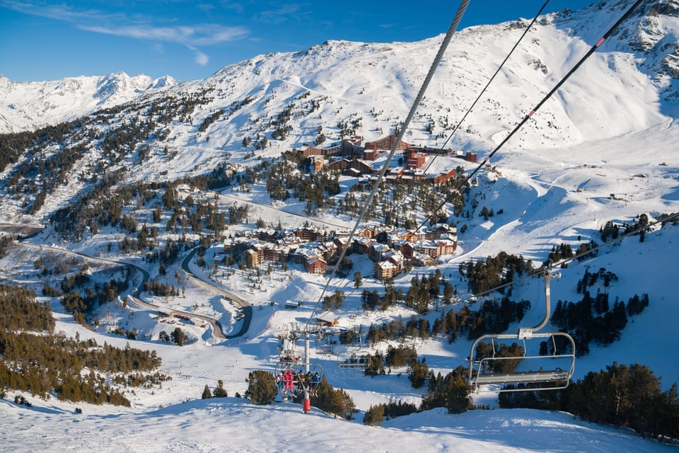
Les Arcs webcams
▶ Watch at the operator ↗
Arcabullepanoramic
▶ Watch at the operator ↗
Arpettepanoramic
▶ Watch at the operator ↗
Snowparkpanoramic
Les Arcs broadcasts its images on its own page: the link takes you there. 6 more cameras on the webcam page. Checked on 25 September 2026.
Snow, opening and weather
Snow report →Open pistes and lifts will appear here during the season, as published by the resort. Out of season we show nothing rather than a misleading zero.
Good snow from December to May: a long, reliable season. Snow cover month by month →
3-day forecast
Village 1,600 m · top 3,226 m
Forecast corrected for altitude; fresh snow = forecast total at the top; UV = peak of the day. Beyond 3 days, check the resort’s own report. Source:Open-Meteo.
Seven criteria rated from 1 to 5 stars, in half-stars, from this page's sourced data. A rating is a rank among the 315 French resorts we cover — 5 stars means “among the best in France on this point”, not “perfect”. Nobody types these in.
- SnowCan you count on the snow?4.5 / 5
Top of the ski area: 3,226 m · Bottom of the pistes: 1,600 m · Days above 30 cm, December to March, model: 99% · Glacier skiing
- Ski areaIs there enough to ski all week?4.5 / 5
Km of pistes at the resort: 200 km · Km skiable from the resort, linked area included: 425 km · Balance between piste levels: 91%
- ValueIs the lift pass reasonable for what you get?2.5 / 5
Adult day pass: €78 · Day pass price per km of pistes: €0.18/km · Adult 6-day pass: €412 · Price read at a neighbouring resort of the same area
- Families and beginnersIs it right for children and beginners?1.5 / 5
Share of green and blue pistes: 56% · Sledging runs: 0 · Ice rink, pool, rail sledge…: 0
- AccessIs it easy to get to?2 / 5
Average drive time from 20 major cities: 5 hr 28 · Nearest railway station: 41 min · Nearest airport: 2 hr 16
- Atmosphere and après-skiIs there life in the evening and off the slopes?5 / 5
Bars and pubs: 8 · Nightclubs: 2 · Restaurants: 52 · Upcoming events: 19 — index: what the map and the listings publish
- Luxury and comfortHow upmarket is the resort?5 / 5
5-star hotels: 2 · 4-star hotels: 2 · Spas and saunas: 1 · Jewellers, watchmakers, fashion boutiques: 2 · Adult day pass: €78 — index: what the map and the listings publish
“Atmosphere” and “Luxury” are indexes: they count what OpenStreetMap and the event listings publish within 2.5 km (bars, nightclubs, rated hotels, spas, upcoming events), not what you experience there. A zero means “nothing mapped”, not “nothing there”. Sources per criterion: snow (altitudes declared by the resort (ANMSM, official website), STRMTG register, OpenStreetMap; snow depth observed at the Météo-France station, ERA5-Land model) ; ski area (figures declared by the resort (ANMSM, official website), national lift register (STRMTG), OpenStreetMap) ; value (the resort’s official price list) ; families and beginners (OpenStreetMap pistes, price list, ESF ski school, Famille Plus label, OpenStreetMap leisure) ; access (OSRM drive times from 20 cities, SNCF stations, GTFS shuttles, airports) ; atmosphere and après-ski (bars, nightclubs and restaurants within 2.5 km (OpenStreetMap), upcoming events (OpenAgenda), collective tourist beds (INSEE)) ; luxury and comfort (rated hotels within 2.5 km (OpenStreetMap) and by category across the commune (INSEE), spas and boutiques (OpenStreetMap), day pass price).
Lift passes 2026-2027
All prices (child, family, season) →€412 6 days
Read on the official price list, full price, excluding promotions. Pass Essentiel (Paradiski) pass, covering the whole linked area, read on the list of Peisey-Vallandry. 2026-2027 season. Official price list ↗
117 pistes, by level
14 green51 blue35 red17 black
- Skiable vertical
- 1,626 m
- Cross-country skiing
- 10 named trails — 26 km of marked loops (17 km of distinct track: the loops overlap), 5.1 km from the resort
- Snowpark
- 1 mapped zone — Snow Park (intermediate)
Ski-area figures — village: ANMSM — figures declared by the resort (25 Sept); top, km of pistes, km of the linked area, pistes by level: Resort’s official website (read by SkiRadar) (23 Sept) .
The ski area in figures
Measured on 24 September 20267 kmLongest piste — Grands Mélèzes (red), 540 m of vertical
721 mBiggest vertical without changing piste — 2,118 → 1,397 m, 2 km
3,201 mHighest lift top — Aiguille Rouge (cable car)
60 kmTotal length of lifts — 66 lifts mapped
16,981 haSki area boundary (OSM)
7,270Inhabitants — Bourg-Saint-Maurice (INSEE 73054)
Measured on OpenStreetMap (altitudes: IGN RGE ALTI), not taken from the brochure. The vertical above is that of one piste, not of the whole ski area. Population: INSEE municipal population via geo.api.gouv.fr.
Staying and hiring gear in Les Arcs
The partners covering this resort, shown side by side, and the shop to kit out before you leave. Some links earn us a commission — never at the expense of the price or of the data.
Stay & accommodation
Neilson
UK tour operator (ATOL 10794): Neilson chalets and hotels in the resort, flying from UK airports on Sundays.
Holidu
Holiday-rental comparison site.
Ski Planet
Self-catering flats and all-inclusive ski holidays at the foot of the slopes, since 1999.
Gear & equipment
Absolute Snow
UK ski and snowboard shop — delivers to UK addresses only.
Hardloop
Mountain gear shop: ski touring, avalanche safety, winter clothing.
Ski schools and practical information
Resort contacts and documents
- Tourist office
- Les Arcs Bourg Saint Maurice Tourisme · 35 rue de la Gentiane, 73700 · 0479071257 · contact@lesarcs.com (declared by the resort, ANMSM)
- Resort app
- Android (declared by the resort, ANMSM)
In case of accident
112 — the European emergency number, free of charge, triggers mountain rescue. On the pistes, the ski patrol number is printed on the piste map and at lift ticket offices. Piste rescue is charged: check your insurance or take the option sold with the lift pass.
 Resort data: declared by Les Arcs Bourg Saint Maurice Tourisme and distributed by ANMSM · read on 25 September
Off the pistes: off-piste and ski touring
The resorts for off-piste skiing → Safety. Off-piste terrain is neither marked nor made safe by the resort: a transceiver, a shovel, a probe and reading the avalanche bulletin are the minimum — and going with a mountain guide is better still. Today's avalanche risk (Météo-France scale of 1 to 5) will appear here during the season.
Piste map
Open on OpenSnowMap ↗Official piste map
Pistes coloured by level, lifts as lines. The resort’s official map is the reference in season.
Base map © OpenTopoMap (CC-BY-SA) · pistes © OpenSnowMap (CC-BY-SA) · data ©OpenStreetMap contributors (ODbL).
Getting to Les Arcs
From Paris: 7 hr 52 (699 km) by road.
By road
- From Chambéry: 2 hr 05 · 131 km
- From Annecy: 2 hr 20 · 124 km
- From Grenoble: 2 hr 21 · 160 km
- From Genève: 3 hr 02 · 170 km
- From Lyon: 3 hr 15 · 229 km
From other major cities (15)
- From Valence: 3 hr 24 · 253 km
- From Saint-Étienne: 3 hr 48 · 278 km
- From Dijon: 5 hr 07 · 430 km
- From Clermont-Ferrand: 5 hr 08 · 395 km
- From Besançon: 5 hr 21 · 343 km
- From Montpellier: 5 hr 31 · 457 km
- From Marseille: 5 hr 36 · 466 km
- From Nice: 6 hr 39 · 470 km
- From Perpignan: 6 hr 53 · 605 km
- From Strasbourg: 7 hr 09 · 513 km
- From Nancy: 7 hr 14 · 641 km
- From Toulouse: 7 hr 49 · 691 km
- From Paris: 7 hr 52 · 699 km
- From Bordeaux: 9 hr 06 · 784 km
- From Pau: 9 hr 43 · 881 km
Excluding traffic and winter conditions; passes closed in winter are avoided.
By train
Bourg-Saint-Maurice station
regional station · then 41 min drive (28 km)
Nearest main station: Chambéry - Challes-les-Eaux, 2 hr 03 by road.
Shuttles and buses from the station: see the resort’s official website.
By plane
- Chambéry-Savoie (CMF): 2 hr 16 by road · 138 km
- Grenoble-Alpes-Isère (GNB): 2 hr 54 by road · 206 km
Take me there
These links open the app with Les Arcs as the destination. Your starting point is never sent by us — the app asks you for it, if you agree.
Road conditions
From 1 November to 31 March, snow chains or winter tyres are compulsory in most mountain areas (French “Loi Montagne II”).
Driving times computed on the OpenStreetMap road network (OSRM), SNCF stations (open data), airports (Wikidata). Indicative, not a timetable: allow extra time in snow.
What's on around Les Arcs
All 19 upcoming events →-

25 September 2026 – 26 September 2026
Exposition "Médaillons" : aquarelles d'Antoine Belmère
Médialudothèque de Bourg Saint Maurice · Bourg-Saint-Maurice
Le point de départ de l'exposition, c'est le "médaillon", aussi bien son usage en sculpture qu'en peinture. On peut en découvrir un exemple sur la façade de la Maison des Têtes à Bourg Saint Maurice.
Source: OpenAgenda, agenda “Les Evènements en Haute Tarentaise” · View on OpenAgenda ↗
Also near: Bourg Saint Maurice (0.6 km), La Rosière (6.5 km), Montchavin (6.6 km), Peisey-Vallandry (7.7 km)
-
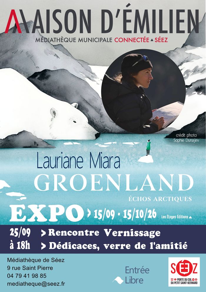
25 September 2026 · 18:30
Rencontre autrice / Expo / Vernissage
Maison d'Emilien - Médiathèque de Séez · Séez
Rencontre autrice / Dédicaces / Expo / Vernissage
Source: OpenAgenda, agenda “Les Evènements en Haute Tarentaise” · View on OpenAgenda ↗
Also near: Bourg Saint Maurice (2.2 km), La Rosière (3.9 km), Montchavin (8.5 km), Peisey-Vallandry (9.1 km)
-

25 September 2026 · 19:30
Soirée jeux : rôles cachés
Médialudothèque de Bourg Saint Maurice · Bourg-Saint-Maurice
La Ludo vous invite à une soirée pleine de mystères, de stratégies… et de trahisons ! Qui dit la vérité ? Qui manipule le groupe ? Saurez-vous démasquer les imposteurs avant qu’il ne soit trop tard ?
Source: OpenAgenda, agenda “Les Evènements en Haute Tarentaise” · View on OpenAgenda ↗
Also near: Bourg Saint Maurice (0.6 km), La Rosière (6.5 km), Montchavin (6.6 km), Peisey-Vallandry (7.7 km)
-

26 September 2026 · 10:00
Partagez vos lectures
Maison d'Emilien - Médiathèque de Séez · Séez
On parle de lilvres
Source: OpenAgenda, agenda “Les Evènements en Haute Tarentaise” · View on OpenAgenda ↗
Also near: Bourg Saint Maurice (2.2 km), La Rosière (3.9 km), Montchavin (8.5 km), Peisey-Vallandry (9.1 km)
-

26 September 2026 · 10:00
Conte, jeu et bricolage : au pays des gnomes
Médialudothèque de Bourg Saint Maurice · Bourg-Saint-Maurice
Conte, jeu et bricolage en deux séances pour le séchage de l'argile.
Source: OpenAgenda, agenda “Les Evènements en Haute Tarentaise” · View on OpenAgenda ↗
Also near: Bourg Saint Maurice (0.6 km), La Rosière (6.5 km), Montchavin (6.6 km), Peisey-Vallandry (7.7 km)
Events published on OpenAgenda by the agendas named above, kept when they take place within 10 km of the resort. We organise nothing: times, prices and cancellations are the organiser's.
The area offers 200 km of alpine pistes (425 km across Paradiski), 117 marked pistes (14 green, 51 blue, 35 red, 17 black), plus a snowpark.
Les Arcs belongs to the linked Paradiski area: one lift pass covers the neighbouring resorts.
Measured on the OpenStreetMap map: the longest piste runs 7 km (Grands Mélèzes) and the highest lift tops out at 3,201 m.
Access: 2 h 05 by road from Chambéry and 41 min from Bourg-Saint-Maurice railway station.
9 official webcams show the pistes live (on the French page).
Frequently asked questions
How high is Les Arcs?
Les Arcs sits at 1,600 m at village level, and its ski area rises to 3,226 m.
How many kilometres of pistes does Les Arcs have?
Les Arcs has 200 km of slopes (425 km across Paradiski).
What is the longest piste in Les Arcs?
The longest piste is Grands Mélèzes: 7 km (red run), for 540 m of vertical. Measured on the OpenStreetMap map, segments of the same name and level joined end to end, altitudes from the IGN RGE ALTI terrain model — a resort sometimes advertises a longer run by chaining several pistes.
How high do the lifts go in Les Arcs?
The highest lift, Aiguille Rouge, tops out at 3,201 m (IGN RGE ALTI terrain model). The 66 lifts mapped on OpenStreetMap total 60 km.
How much is a lift pass in Les Arcs?
The adult day pass for the Pass Essentiel (Paradiski) linked area costs €78 and the 6-day pass €412 (2026-2027 season, read on the official price list of Peisey-Vallandry).
How do I get to Les Arcs?
By road, Les Arcs is 2 hr 05 from Chambéry (131 km), excluding traffic and winter conditions. By train, the nearest station is Bourg-Saint-Maurice, 41 min by road from the resort. The nearest airport is Chambéry-Savoie, 2 hr 16 away.
How long is the drive from Paris to Les Arcs?
7 hr 52 for 699 km from central Paris, excluding traffic and winter conditions. Computed on the real road network (OpenStreetMap): allow more on a school-holiday Saturday.
Is the snow reliable in Les Arcs?
Good snow from December to May: a long, reliable season. This verdict rests on 10 winters of reanalysis (estimate, 2015-2025); in season the daily report prevails.
Is Les Arcs good for beginners and families?
56% of the pistes are green or blue: a rather technical area.
Nearby resorts
Full page in French. The French page carries the editorial guides and a few extra readings; every figure, webcam and price on this page is the same one. Les Arcs in French →
Every figure carries its source and date; a missing figure shows as “—”, never estimated. Embed this widget on your site